Cosa sono le aree interne del Paese Italia? Qual è l’immagine che associamo ad esse? Come può la fotografia contribuire a nutrire l’immaginario collettivo di questi luoghi e diventare metodo di lavoro, integrando le altre discipline nell’ambizioso compito di rilanciare questi territori?
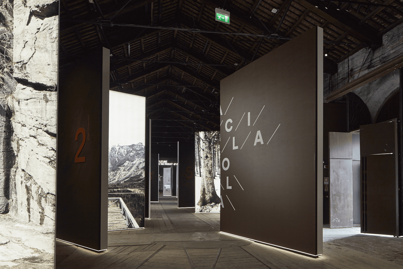
Urban Reports ha partecipato al collettivo multidisciplinare coordinato da Mario Cucinella, curatore del Padiglione Italia alla XVI Mostra internazionale di Architettura della Biennale di Venezia, nella costruzione del progetto Arcipelago Italia. Progetti per il futuro dei territori interni del Paese.
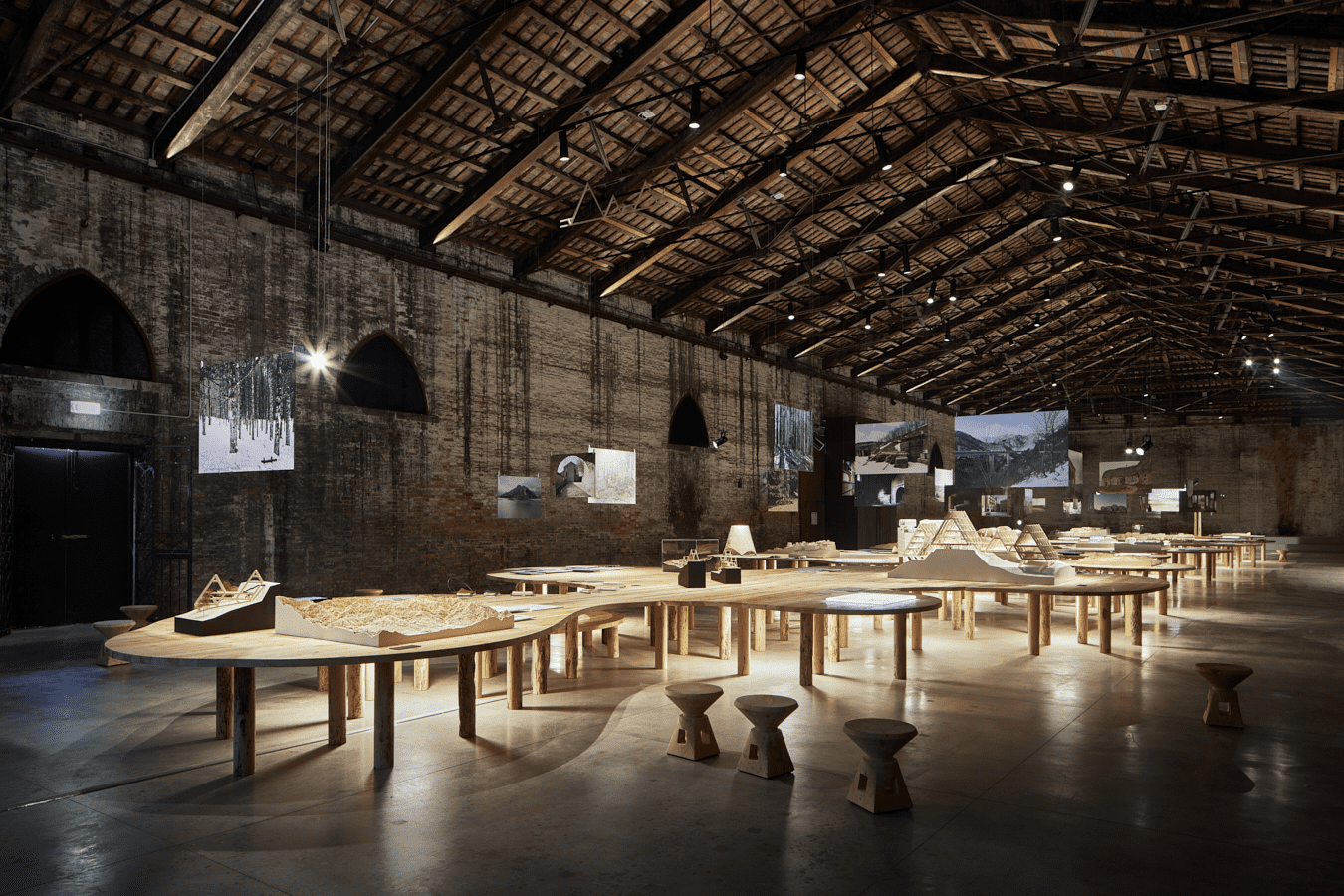
Un collettivo composto da architetti, urbanisti, storici, esperti di diverse discipline, che ha lavorato su 6 progetti sperimentali, in 5 aree strategiche, pensati come potenziali occasioni di crescita e sviluppo per i territori delle aree interne del nostro paese: Gibellina e il Belice, Camerino e il cratere del terremoto 2016, Ottana e la Barbagia, l’Appennino tosco-emiliano e le Foreste Casentinesi, Matera e la Valle del Basento.
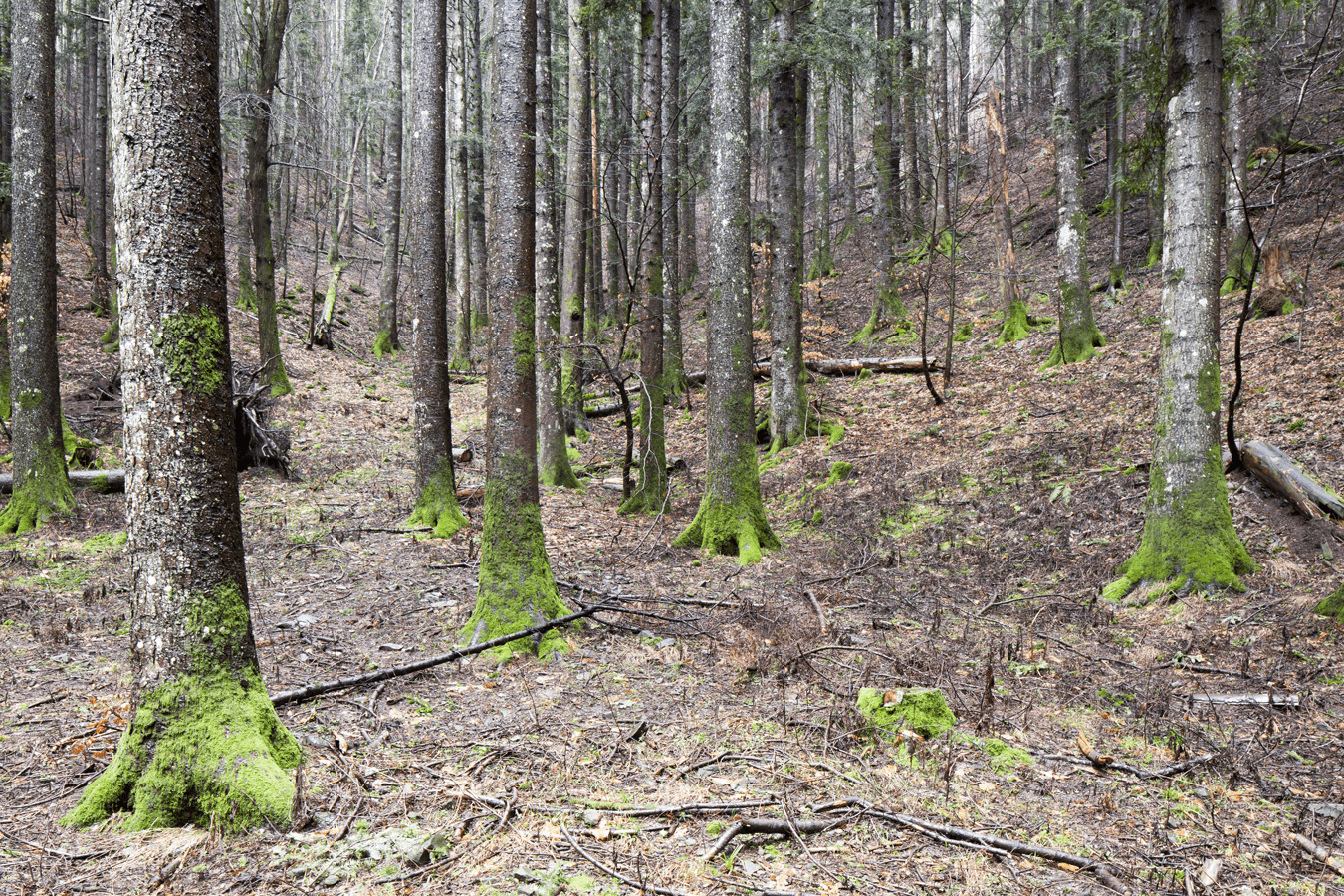
Il sottobosco e la presenza del muschio sugli alberi ©Urban Reports.


Per questo progetto, Urban Reports ha proposto e sperimentato l’uso della fotografia come strumento narrativo.
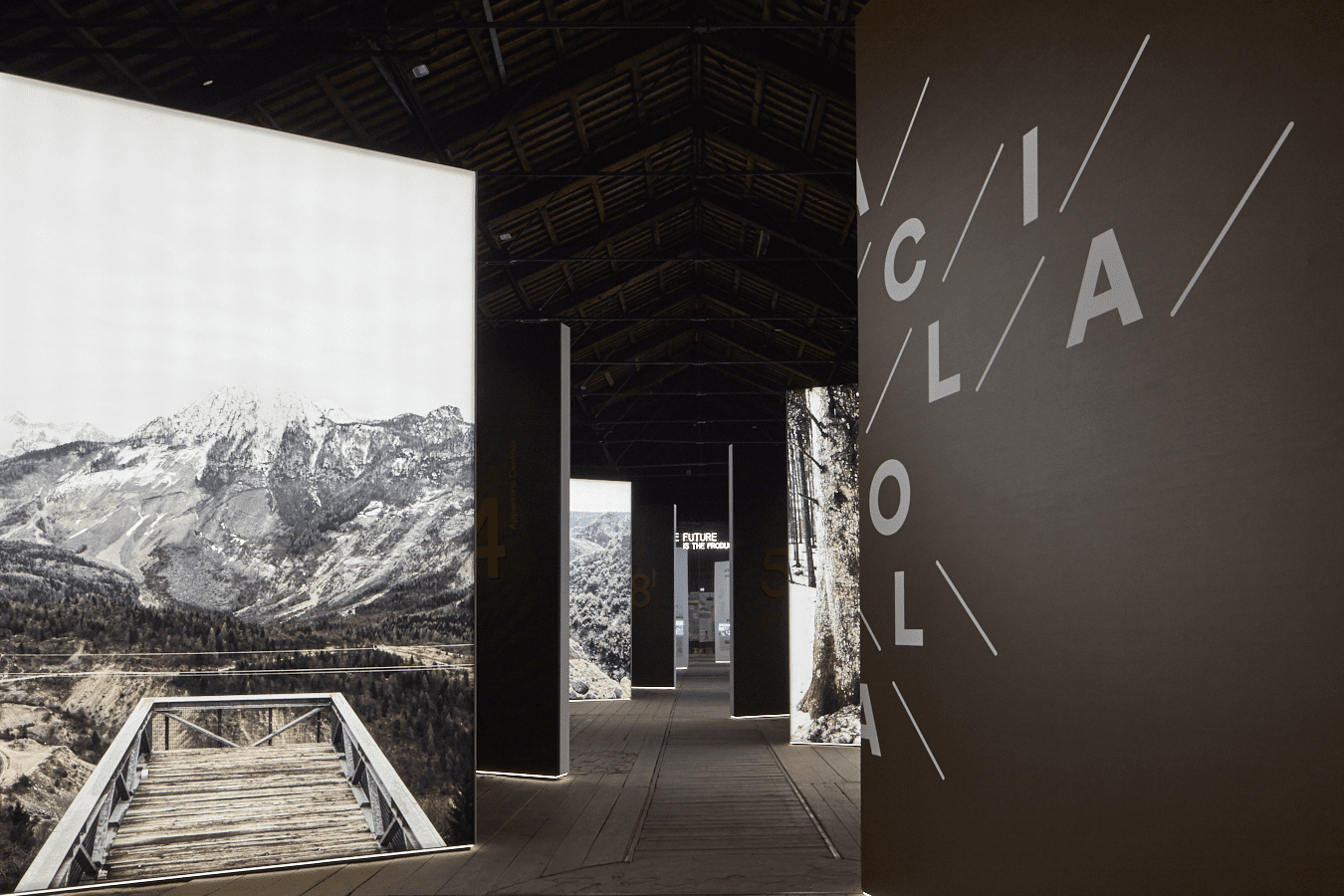
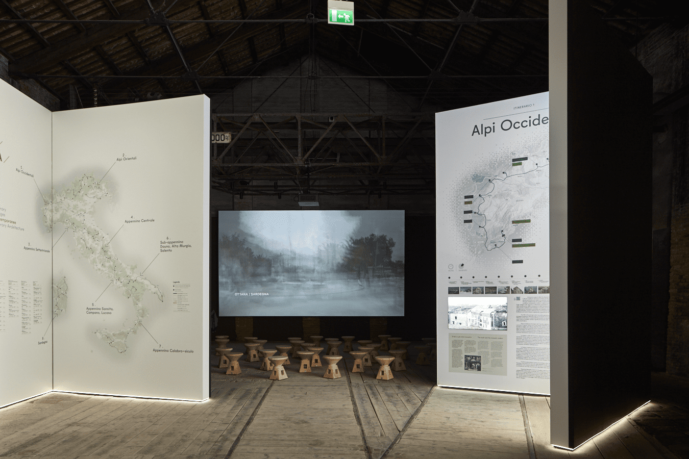
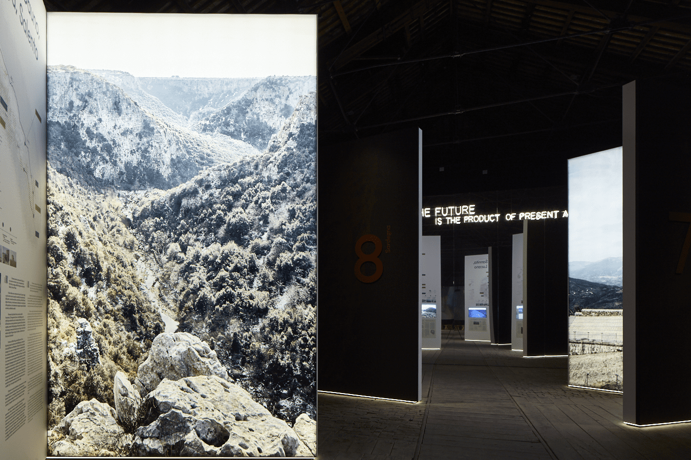
Percorrendo la dorsale del paese, dalle Alpi, lungo gli Appennini fino al Mediterraneo, abbiamo cercato di racchiudere in otto immagini emblematiche gli otto itinerari che si snodano tra architetture, percorsi storici e paesaggi pregevoli, per poi soffermarci sulle 5 aree strategiche e costruire un racconto a supporto della riflessione sul presente e il futuro di questi luoghi.
La fotografia come strumento meta-progettuale per osservare e comprendere le dinamiche territoriali, sostenere il percorso creativo dei progettisti e incoraggiare la riflessione sui caratteri identitari dei luoghi e i futuri scenari di trasformazione; per aprire a nuove prospettive e possibilità di analisi; un potente mezzo di comunicazione in grado di nutrire un nuovo immaginario collettivo. Questo lavoro è stato un percorso lungo sei mesi che ci ha permesso di ritornare più volte sui territori, “metabolizzare” il paesaggio e farlo diventare qualcosa che vivesse dentro di noi (come diceva Gabriele Basilico). È stato un viaggio attraverso i luoghi, fatto di parole, letture, camminate e incontri particolarmente felici con i progettisti, i consulenti, gli esperti e la popolazione locale che hanno svelato storie e sguardi, e guidato i fotografi alla scoperta di territori e paesaggi ancora poco conosciuti.
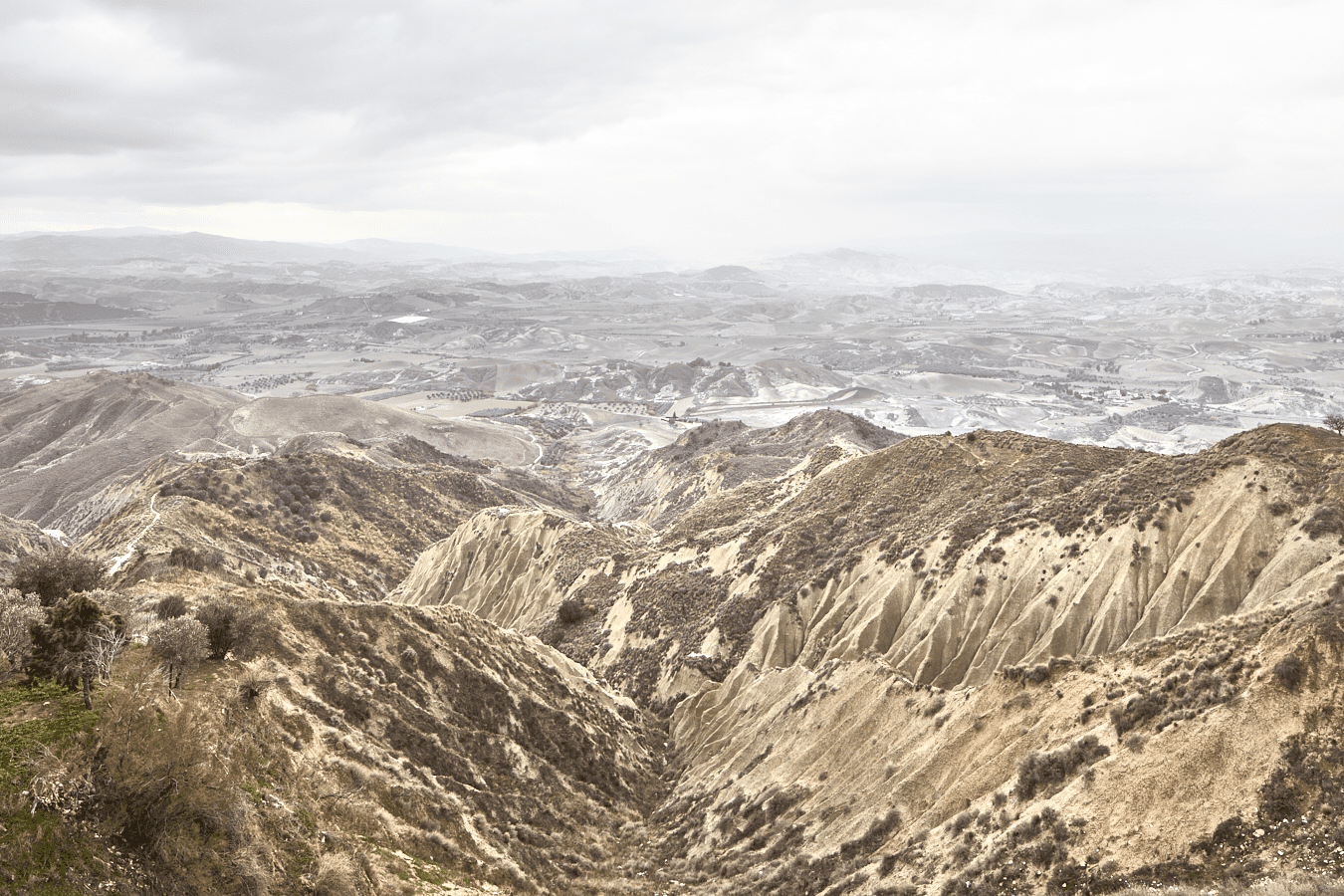
I calanchi di Pisticcci ©Urban Reports.
Guidato dalle emozioni che provoca il paesaggio, il risultato del racconto fotografico è una raccolta di iconemi, elementi significanti e illustrativi di ciascun territorio: la natura selvaggia e arcaica della Barbagia; le connessioni reali, possibili o immaginarie della Valle del Basento; la dimensione spirituale e produttiva delle Foreste Casentinesi; le tracce della storia e degli eventi nella Valle del Belìce e il rapporto profondo tra la matericità maestosa del sottosuolo di Camerino e la ricchezza culturale del suo territorio.
Un lavoro che ha prodotto un nuovo livello di lettura per ogni ambito e quindi, nell’insieme, una sintesi visiva dell’identità di questi territori.

Tricarico ©Urban Reports.
“Arcipelago Italia” Project
How Italy’s internal areas look like? What kind of image do we associate to them? How can photography contribute to nurture and fuel the collective imaginary of these places and become a working method integrating the other disciplines in the ambitious task of reviving these territories?
Urban Reports was part of the interdisciplinary team coordinated by Mario Cucinella, curator of the Italian Pavilion at the 16th International Architecture Exhibition of the Venice Biennale, involved in the creation of the project “Arcipelago Italia. Projects for the future of the country’s internal territories”.
A collective gathering architects, urban planners, historians, experts in participatory planning and different other disciplines, who have worked together on 6 experimental projects in 5 strategic areas conceived as potential opportunities for growth and development for the territories of the internal areas of Italy. The strategic areas are: Appennino Tosco Emiliano and the Casentine Forests, Gibellina and the Belice Valley, Camerino and the crater of the 2016 earthquake, Ottana and Barbagia, Matera and the Basento Valley.
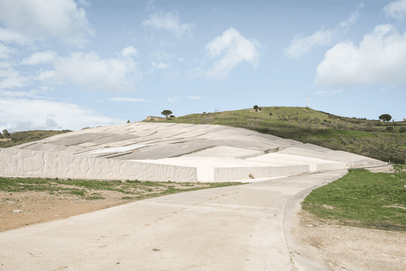
Il Cretto di Burri sulla via Alcamo a Gibellina Vecchia ©Urban Reports.


For this project Urban Reports has proposed the use of photography as narrative tool. Covering the ridges of the country, from the Alps along the Apennines towards the Mediterranean sea, we sought the eight emblematic images for the eight itineraries across valuable architecture projects, historical sites, trails and landscape attractions. But we also specifically worked on the five strategic areas and build a territorial narrative capable of supporting a reflection on the present and the future of these places.
Photography has a medium to observe and understand the territorial dynamics, support the architects creative path and encourage the reflection on those features of places and the future scenarios of transformation; photography used to open up new perspectives and potentials for analysis; a powerful means of communication capable of fueling a new collective imaginary. A six-month work which has enabled us to go back to the territories more than once, “metabolize” the landscape and turn it into something which has become part of us (as Gabriele Basilico used to say). It has been a journey through various places, made of words, readings, walks and particularly positive encounters with the architects, the consultants, the experts and the local populations. All these experiences have revealed stories and gazes, guiding us to the discovery of territories still unknown.
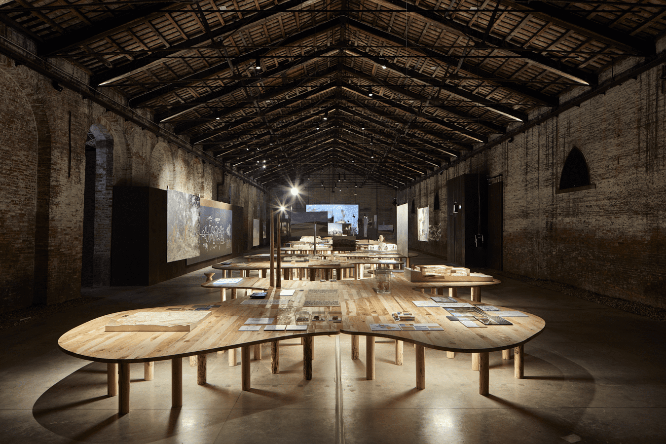
Vista dello spazio espositivo al Padiglione Italia, 2018 ©Urban Reports.
Guided by the emotions provoked by the landscape, the photographic tale is made of iconemes, that are significant elements illustrating each individual territory: the primitive wilderness of Barbagia; the real, possible or imaginary connections of the Basento Valley; the spiritual and productive dimension of the woodlands in the Casentino Forests; the traces of dramatic history and events in the Belice Valley; and the deep relationship between the majestic nature of the caves and the cultural richness of its territory.
A photographic campaign that has produced a new level of interpretation for each area and therefore, as a whole, a visual synthesis of the identity of these territories.


